 The health of many communities is often dictated by water. Too little water, and there’s a drought. Too much water, and you have a flood.
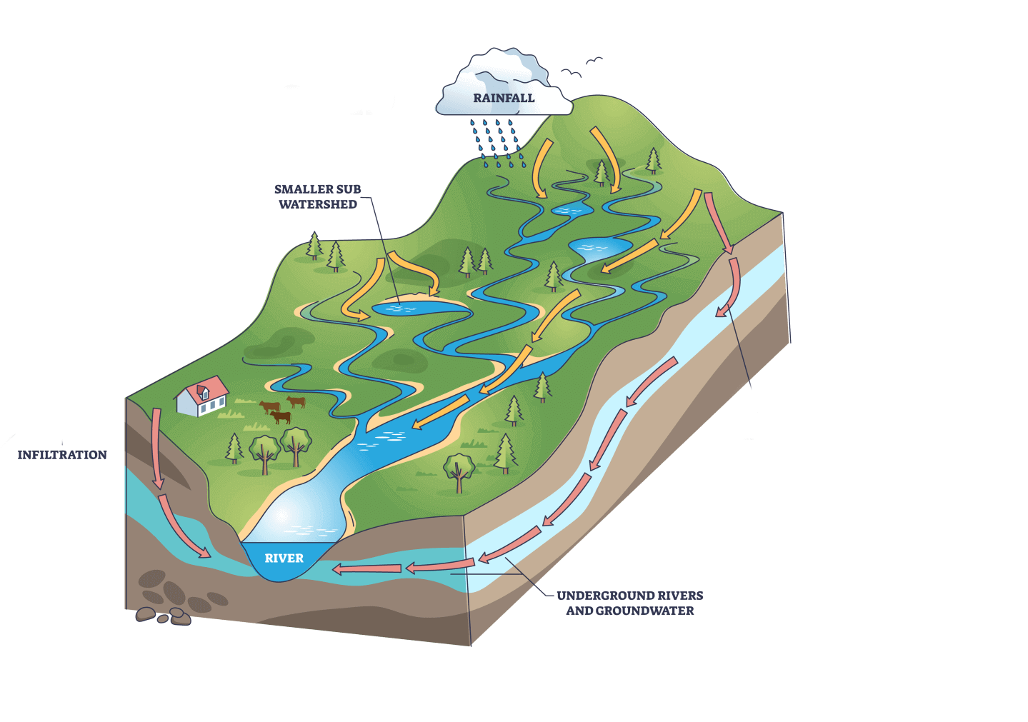
To better understand how all this works, we turn to watersheds. A watershed — also known as a drainage basin or catchment — is an area of land where all the water collects and flows to a common point, like a river, lake, or ocean.
The size and features of a watershed helps us determine how much water there is in a given area and how that water moves. We can use this knowledge to inform infrastructure and land use planning to better manage floods and reduce risk.
In this post, we’ll discuss the connection between watersheds and floods, and how states are using watershed-level approaches to solve flooding problems.
How watersheds work
One way to think of watersheds is as a giant bathtub. Rainwater and runoff from the surrounding land come together and empty into the same place, much like water runs down a drain in a tub.
Watersheds act as natural drainage systems, collecting and channeling water from precipitation, such as rainfall or snowmelt. When rain falls within a watershed, it accumulates on the land’s surface or soaks into the soil. The water then moves downhill, following the slopes and eventually converging into wetlands, streams, rivers, lakes, and the ocean.
Importantly, the makeup of watersheds influences how often floods happen, and how bad they are when they do happen.

Topography plays a crucial role here, as watersheds with steep slopes tend to promote faster runoff and more rapid flow of water downstream. Ground cover, including soil and vegetation, also affects permeability (how easily water can be absorbed) and saturation levels (how much water has already been absorbed), which determine how water is retained or released within the watershed. Watersheds with low permeability or high saturation are more prone to generating runoff and increasing flood risk.
Though some aspects of watersheds are unchangeable, others are a direct result of human activity. Deforestation, urbanization, and the construction of impervious surfaces change the natural flow of water, reducing permeability and increasing runoff.
Forests and wetlands, on the other hand, can act as natural buffers by absorbing and storing water, helping regulate flow and reduce flood risk.
Flood modeling and mapping
Considering all of these aspects, planners and engineers can figure out how water flows within and across watersheds through flood models. Flood models allow communities to make data-informed decisions, such as how to design water infrastructure, study natural systems, or map floodplains. Since modeling simulates where water is (hydrology) and where it will go (hydraulics), we can better understand the flow of rainfall runoff and riverine flooding.
Runoff occurs when the land within a watershed becomes saturated or impermeable due to factors like soil type, vegetation cover, or urbanization. In areas covered by impervious surfaces, like concrete or asphalt, water cannot soak into the ground and instead flows rapidly over the surface, leading to excess water, or runoff. Runoff can overwhelm the capacity of rivers and streams, leading to increased flood risk downstream.
Flood models map out how water interacts with a watershed’s topographies, ground cover, and hydraulic features like levees or stormwater pipes. Using this information, flood models — when informed by accurate, forward-looking data and consistent methodology — can determine how much runoff to expect. Information pulled out of models can inform flood planning, which can be designed to reduce the amount of runoff in a watershed.
Solutions
Recognizing the connection between watersheds and flooding, entities can put in place strategies to effectively manage floods and reduce risk.
Healthy vegetation cover and wetlands restoration can reduce flood risk by slowing down and retaining water. Green infrastructure, like permeable pavements and rain gardens, can reduce runoff and increase water absorption within the watershed.
Traditional gray infrastructure, like floodwalls or berms, can also reduce flood impacts for a community. But while such projects can reduce flooding in one area, planners should also consider how flood infrastructure can harm upstream or downstream communities.
Aside from specific flood projects, like green and gray infrastructure, state programs and policies that encourage a regional approach to watersheds can also reduce flood risk. As watersheds can span multiple communities, it’s extremely important for governments to coordinate with upstream and downstream communities when assessing and managing flood risk.
Because they can provide consistent data, planning, and funding across a state, state governments are best positioned to organize watershed-level approaches to flood resilience.
Examples of regional watershed management
Below are some examples of states taking a regional watershed approach to flood modeling and planning. By modeling floods at the watershed level, state governments can assess risk across multiple communities and propose solutions that consider a larger area.
South Carolina Watershed Resilience Plans
As part of the Strategic Statewide Resilience and Risk Reduction Plan, the South Carolina Office of Resilience (SCOR) is developing resilience plans for each watershed in the state. SCOR is coordinating with communities at the watershed level to identify risk and vulnerability, develop flood solutions, and build community capacity.
North Carolina Flood Resiliency Blueprint
The North Carolina Department of Environmental Quality is developing the Flood Resiliency Blueprint to identify and prioritize projects for the state’s watersheds most affected by flooding. The Blueprint will provide communities with information to make decisions, drive investments, and jumpstart projects that reduce flooding for themselves and other communities downstream.
Iowa Watershed Approach
In 2016, the Iowa Flood Center developed the Iowa Watershed Approach (IWA) to develop long-term watershed management plans and conservation practices that work alongside existing agricultural practices. The IWA focused on smaller water-retention projects upstream of major population centers to reduce runoff before it could cause flooding downstream. Through the IWA, Iowa has built nearly 700 flood and water quality projects and invested over $40 million in land conservation.
Watershed approaches to flooding build resilience
By understanding watersheds, we can better understand flooding. Given their makeup, alongside the human activities that take place within them, watersheds significantly influence the occurrence and severity of floods.
By taking a watershed-approach to flooding, communities and states can reduce flood risk, save money, protect life and property, and better model how waters flow across regions. Understanding these connections is the first step in building resilient communities in the face of stronger storms and more frequent flooding.
—
This post was authored by Gian Tavares, AFC Senior Strategy Associate, and Brandon Pytel, AFC Communications Associate.
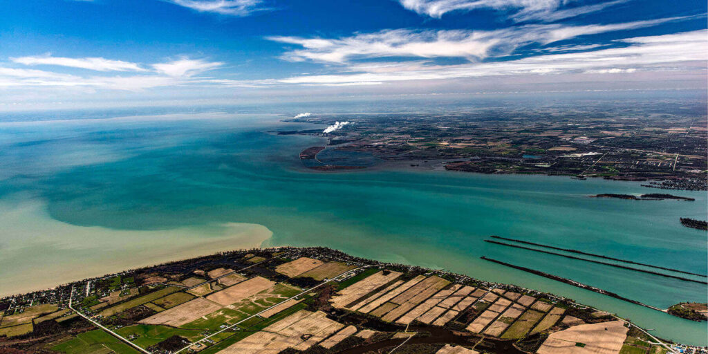
Featured image at top: South entrance of Detroit River to the right and northeast corner of Lake Erie to the left. Credit: NOAA/Flickr


